140M+
PARCELS ON THE MAP
500
RETAIL BRANDS WITH LOGOS
50 + DC
STATES OF TRAFFIC DATA
REMA
The Premier Aerial Editing Suite.
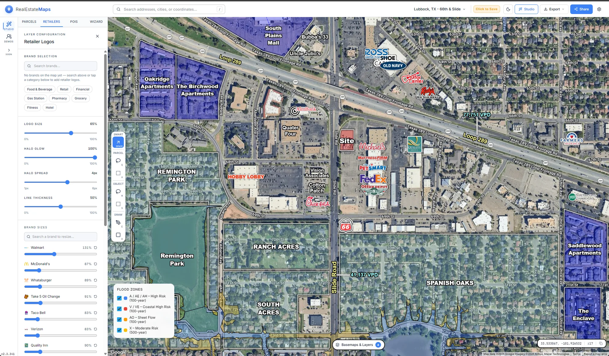
The best-in-class aerial and retailer map creation tool. Mapping, editing, overlays, sizing, and exporting.
All in one program. Hours of research and work, down to a few minutes.
Yesterday you needed mapping software, editing software, and vector drawing software.
Today all you need is REMA.
THE OLD WAY
HOURS PER MAP · 3 LICENSES
HOW IT WORKS
01
Search the site
Type an address, city, or coordinates.
REMA drops you on the aerial at the right zoom.
02
Layer the story
Toggle the layers you want.
Draw the POIs you need.
03
Export & share
Capture a print-ready image or file for the brochure.
Send clients a live, read-only link.
WHY REMA
The map is the marketing.
Logos on the map
Hundreds of retailer brands with halo and sizing controls built for web and print.
Data under the map
Parcel boundaries, flood zones, and traffic counts. Everything you need on one canvas.
Made for the brochure
One-click PNG and PDF export sized for OMs, flyers, and decks or share a live link.
COVERAGE
Every layer, sourced from the record.
Want the receipts? See where every dataset comes from →
REMA draws from public and licensed data so the map you present matches the ground truth your client will verify. These numbers are live from our ingestion ledger.
REMA MOBILE
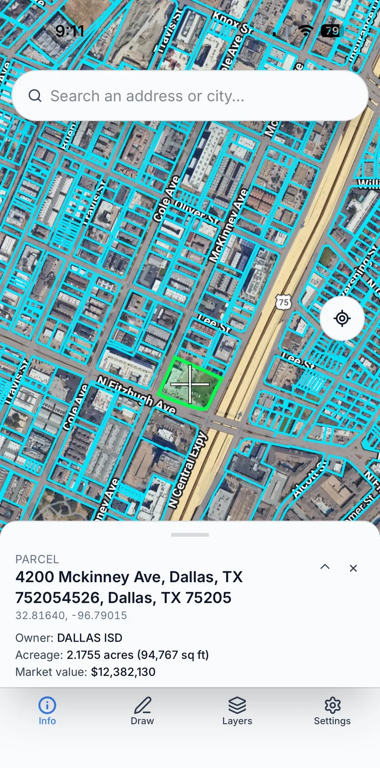
Walk the site.
Pull the record.
Parcels, dimensions, ownership, flood maps, and traffic counts in your pocket. Stand on the corner, tap the parcel, and know what your client will ask before they ask it.
PRICING
One simple plan.
Every layer, unlimited maps and exports, share links, and your own logo library. 7 days free, and you won’t be charged until day 8.
SEE EVERYTHING INCLUDED
FAQ
Questions, answered.
What's included in the plan?+
Everything. Every data layer: retailer logos, parcels, ownership, traffic counts, flood zones, and demographics. Plus unlimited maps, unlimited exports, live share links, and your own logo uploads. One plan, no tiers.
How fresh is the data?+
We sweep every dataset for updates quarterly. Counties, state DOTs, and FEMA move at their own pace, and many don't publish new data even yearly. Our job is to be standing there when they do, so the moment a source refreshes, it lands in REMA.
Can I cancel anytime?+
Yes. Monthly is month-to-month. Cancel any time through your Link account (reached from Settings → Billing) or by emailing support@realestatemaps.app. Your trial requires a card, but you won’t be charged until day 8, and canceling during the trial costs nothing. Annual runs the year you paid for (that's the two free months) and renews at the end of the year unless you cancel first.
Do exports have watermarks?+
No. Your JPGs, PNGs, WEBPs, and PDFs are print-ready and yours. Drop them straight into the OM, flyer, or deck with your own branding.
What if a retailer's logo is missing?+
Upload it yourself in seconds and it maps natively, with sizing, halo, and all. We also add new brands to the shared library on a regular basis.
Do my clients need an account to view a map?+
No. Share links are read-only and open in any browser. Clients see the live map, pan and zoom, and download, without signing up.